Waypoints & Tracks
The creation and management of waypoints and track lines will likely be your most common use of mapping software.
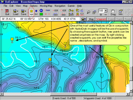
Notice by selecting the "waypoint" button, you can simply click places on the map and the points are created.
The waypoints you create have several things that can be modified individually.
To access the waypoint properties box, you can either double click the waypoint you have just created, or right click it and choose "properties."
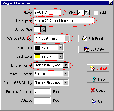
In many cases, you may want to change the name and add a description.
You may also want to change the symbol before the waypoints are uploaded to the gps.
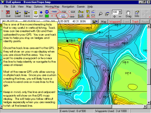
Track lines are normally saved by your gps in the field. A very handy trick is to create them at home before you ever leave.
You can use custom created track lines to help you follow difficult ledges or identify other features. Keep in mind that the track lines will only show on the map display of your GPS. Also, you may want to put a waypoint near the line so you can use the "GoTo" function of your GPS
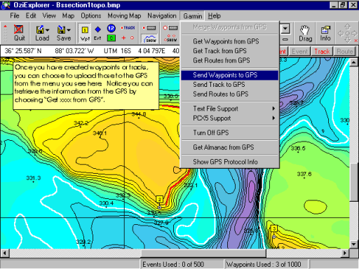
Once you have created the waypoint and/or tracklines you desire. You will need to upload that information to your gps. If you configured the software for your gps make and model, you should see that name on the Menu bar. In this example, it is Garmin.
To send the waypoints to the gps, choose Garmin, Send Waypoints to GPS.
To send the tracks to the gps, choose Garmin, Send Tracks to GPS.