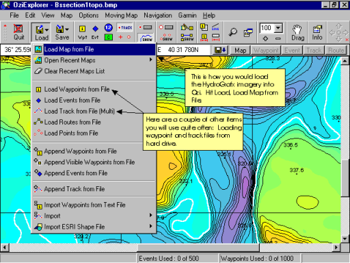
Loading Map Files
The steps below will work if your maps are already calibrated. Those that purchase HydroGrafx images in the last few months of 2001 or later should not need to calibrate the images. It has already been done for you.
If you do need to calibrate your images, see the tutorial section on Calibrating Images and do that first.
The actual steps to load a map file are as follows:
Load
Load Map from File
This will open the "Load Map File" dialog box below.
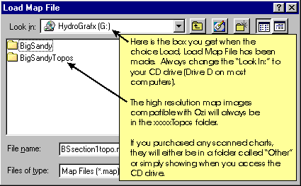
The instructions on the image to the left should help describe where the map files you need exist.
You will need to double click the xxxxTopos folder to display the files contained in that folder.
If you purchased multiple sets of maps, you will see additional folders for those areas of the lake.
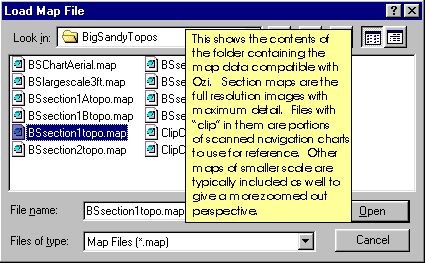
Here are the contents of a folder with all the High resolution section maps and other supporting images. Clips of the older paper charts always have the name "clipxxxxx."
The clips of the old charts work well for the regional map window covered in another section of the tutorial.