Index

Big Sandy River (south)
Kentucky Lake (TN)

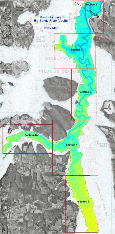
This is the index map for the new Big Sandy (south) imagery.

The area in color is the southern portion of the Big Sandy River that has recently been re-mapped.

NEW depth data was collected from October 2002 - January 2003.

The new maps extend from just north of the powerline to approximately 2 miles south of the junction with West Sandy creek.

The high resolution imagery for Big Sandy is based on over 130,000 depth readings covering more than 1600 acres.

The bay is divided into 6 sections. Topographic images for each section contain a contour interval 0.5 - 1.0 feet.

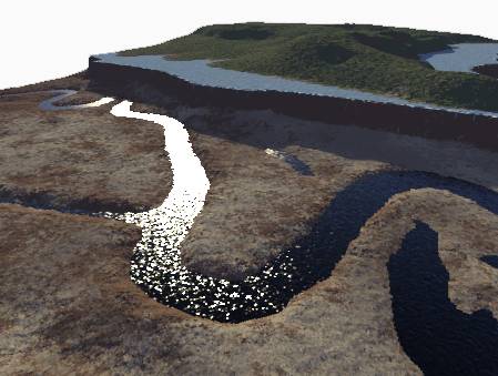
As you see here, the images are actually a hybrid image including the brand new data, plus background imagery of Charts 113.

Also included in the background is aerial photography to help get oriented with real world features.

Topographic images on CD each contain a latitude and longitude grid and coordinates for easy calibration with GPS mapping software.

This is a sample from Section 4 just south the junction with West Sandy creek. Notice the channelized ditch that dumps into Big Sandy river.

Latitude/Longitude grid lines are provide on the topo maps for easy calibration with GPS mapping software.

The contour interval is 0.5 foot above the white contour line and 1.0 foot below the same white line. This is done to reduce stacked contours on steep slopes, while showing as much detail as possible on more gentle slopes.

Hundreds of spot elevations are included on all section maps for easy reference. If you know the current lake elevation, then water depth can be easily calculated.

The next step in 3d viewing has been included with all high resolution Big Sandy South Images

Similar to the most recently released map imagery, the Big Sandy (south) data will also include very impressive "Fly-through" 3d models.

Each map section has it's own animated movie to help visualize the terrain below the water's surface.

This is the same location as above with the view angle roughly southwest. While this is a still image, the product CD includes the animation.

***NOTE****
The simulated water level in this images is 339.0


Other images included on the CD (not shown here) for Big Sandy include:

Clip of navigation chart 113 covering just north of the powerline to the southernmost portion of the Big Sandy Embayment.

A DEMO version of OziExplorer GPS Mapping software is provided on disk to get you started with precision fishing. The HydroGrafx images work flawlessly with this version.


Click Here to Purchase

Click here to see Blood River or Jonathan Creek or Little River or Eddy Creek

Home Page

If you have any questions about this product, you can email us here pdghahs@kentuckyhydrografx.com

Copyright 2001 Kentucky HydroGrafx, LLC, A Kentucky Limited Liability Company.